Maps
San Jose (VTA)
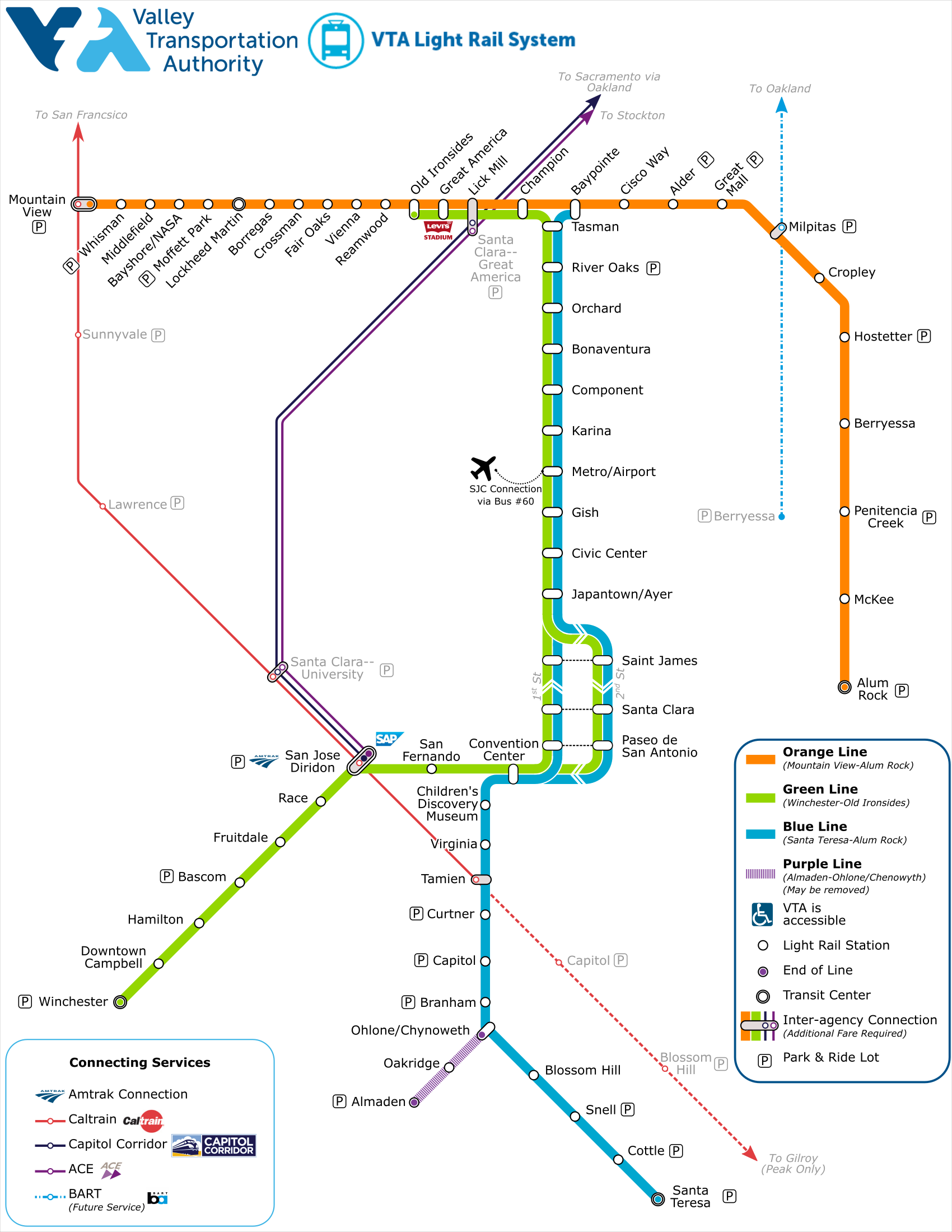
In preparation for the opening of the BART extension into Santa Clara county, VTA was considereing adding a new east-west line connecting Caltrain (in Mountain View) to the new BART terminal at Berryessa. While working on potential operating plans for the new route I needed some graphics to show various potential stopping patterns. Rather than try to re-shape the then-current map to show service along Tasman, I ended up building my own from scratch, and then expanding it to include the entire system. If given free reign I'd probably make more changes, but I needed to keep things as similar as possible to the existing diagram.
Notes on Design: The goal here was to hew as close to the existing design language as possible to allow decisionmakers to more readily grasp the alternatives. Otherwise, I would've made more significant changes, including smoothing out the curves of the connecting services. I do think I nicely captured the interweaving of the lines as they become a one-way couplet in downtown San Jose though, which is elided in the existing map. The fonts are all MS Sans Serif.
Last updated: July 2019