Maps
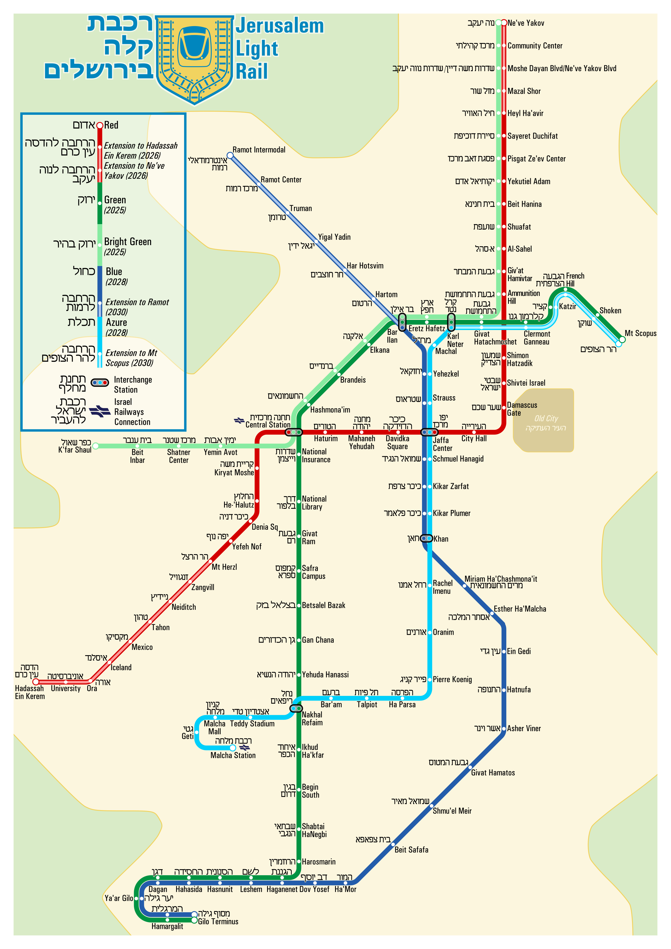
Jerusalem (JNet)
In 2021 I was part of a team bidding on the operations and maintenance of the new Jerusalem light rail blue line. At the time, only the Red Line was complete (though without the extensions to Hadassah Ein Kerem and Ne've Yakov) although the Green Line and Blue Line were approved. The Green Line is actually two lines: one one from Gilo to Mt Scopus, and another ("Bright Green") which starts in Givat Shaul, shares track with the Green Line through the heart of the city, then shares track with the Red Line up to Ne've Yakov. The "Blue Line" is also really 2 lines: one from Gilo to Bar Ilan with an eventual extension to Ramot, and another ("Azure") from Malcha, interlining with the Blue line through Jaffa Center before running with the Green Line out to Mt Scopus.
Notes on Design: I tried to make it bi-lingual (Hebrew+English), which makes it a little more cramped on an A4 page than is ideal. I'm also not 100% sure of all the station names; my Hebrew isn't great and there's limited information in English. Where I'm not sure, I've used the names of the nearest bus stop or cross street. The logo in the corner is a variation on the Jerusalem municipal seal, with a tram and tracks replacing the Lion of Judah and olive branches. The English labels are in Univers Condensed, while the Hebrew is in TW Cen MT Condensed
Last updated: November 2021
