Maps
Bustang (Colorado)
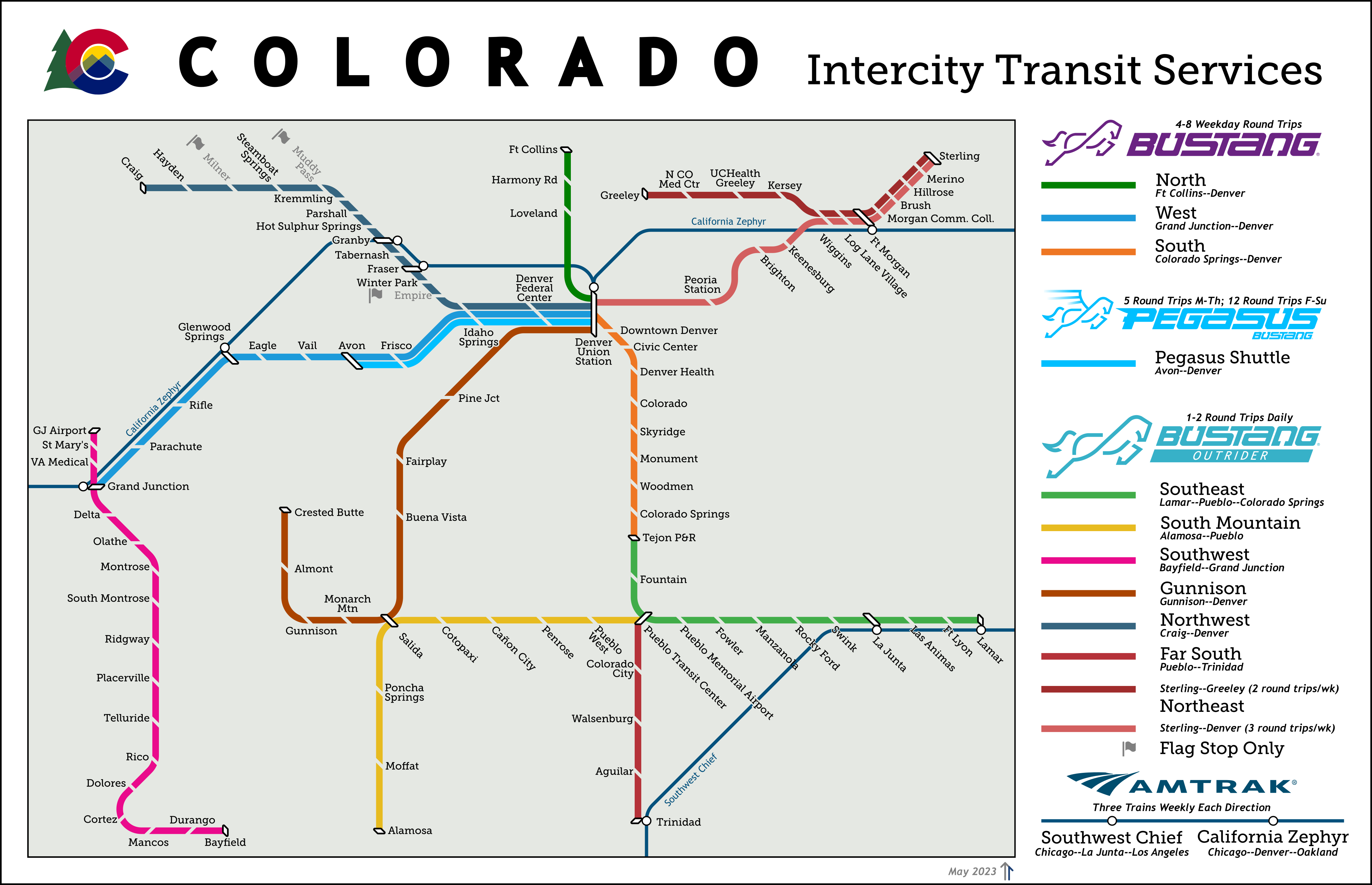
After moving to Colorado I wanted to see if there was a way to get out and explore the rest of the state without driving. CDOT runs buses throughout the state under the Bustang, Outrider, and Pegasus brands. Unforunately, there's only an interactive google map showing the full network. I originally made this diagram in early 2021 and included highways and other geographical details. As the network has grown in complexity it became a lot of detail that didn't really add much information.
Notes on Design: Colorado's square shape allows a diagram like this to remain very faithful to the actual geography of the state. Brighton is technically east of Peoria station, and the spacing on the South line as it leaves Denver isn't as even as it would seem here, but otherwise things line up well. Colorado state departments all share a design style and make it available online, making it easy to ape for a diagram like this. The labels are all Museo Slab, while the subtitles (as well as the state name at the top) are in Trebuchet.
Last updated: April 2023