Maps
New Orleans (NORTA)
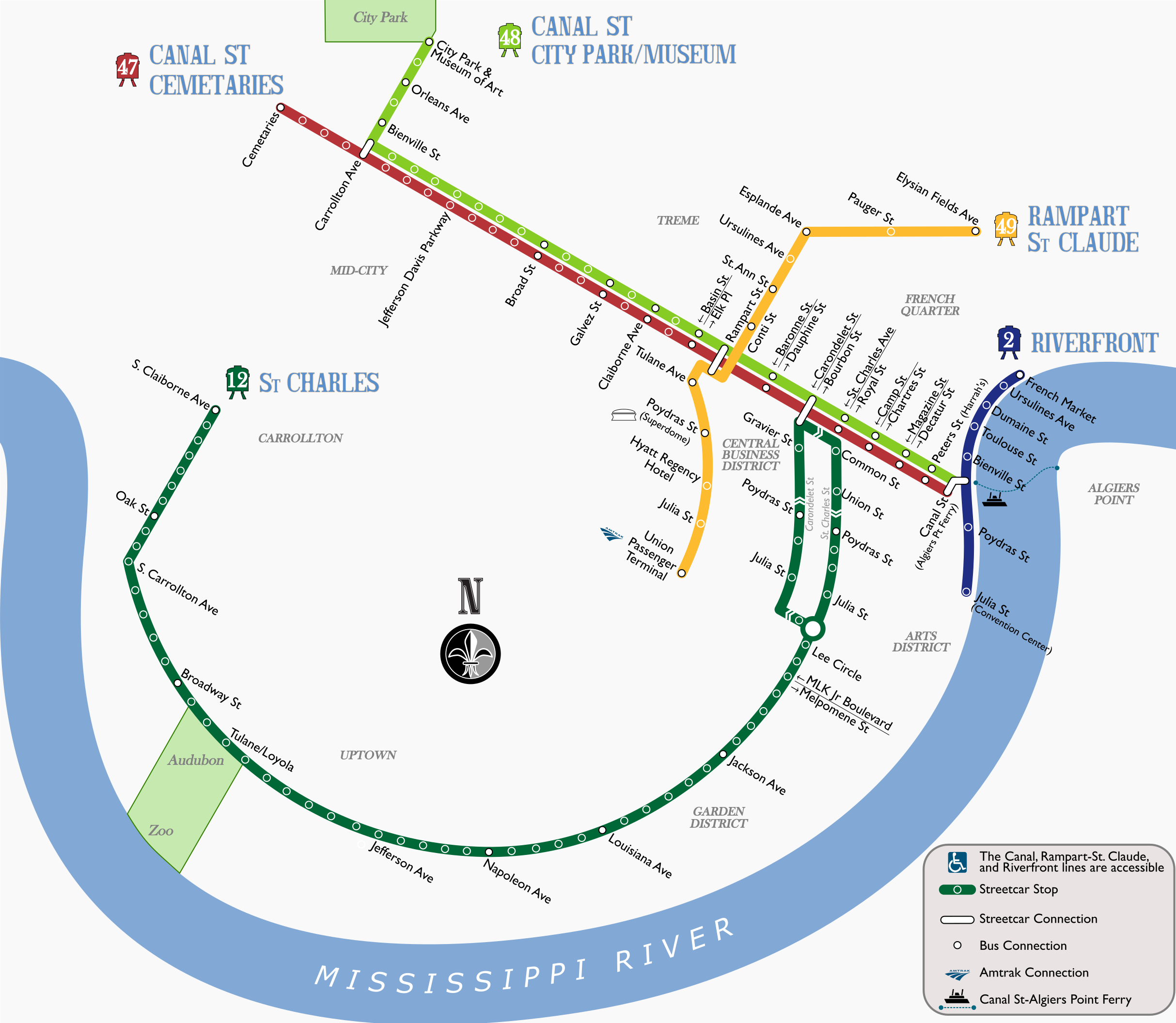
Confession: I made this map years before I ever visited New Orleans. But in doing some research for the 2019 LRT Conference, I saw that the city's streetcar maps were either out of date (still showing the Rampart-St Claude line as UPT-Loyola) or were separated into pieces (i.e. a separate line diagram for the St. Charles Line from the rest of the system). So I made a new one.
Notes on Design: This was one of my first attempts to really use curves in a map, and it shows. I don't like how the 48 turns under the Carrollton Ave station marker, the tight turn of the 49 as it approaches Canal St, or the awkward angles of the station labels along the 12. But the simple arrows for the street directions on lower Canal work well enough. The station labels are in Gill Sans MT, while the parks and neighborhoods are in Baskerville Old Face. The line names and numbers are based on Cameron Booth's digitalization of the street name tiles embedded in sidewalks around the city.
Last updated: August 2018